Storms Bring Needed Increase to Depleted Reservoirs Across State
By Thomas Hughes | Bay City News Foundation
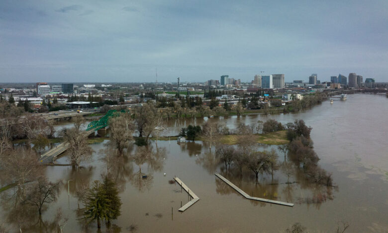
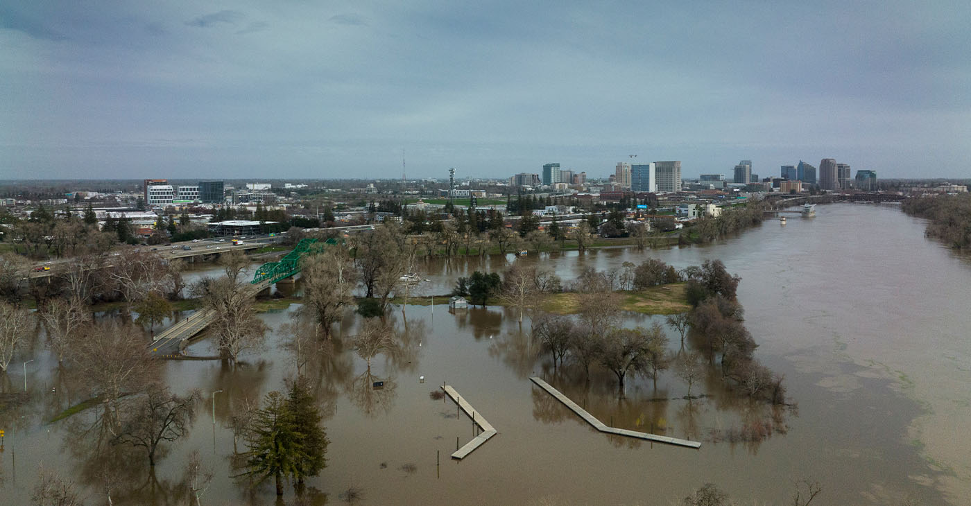
The Sierra Nevada snowpack and California reservoirs received a huge boost from recent and ongoing storms, but not enough to end current drought conditions, officials with the state Department of Water Resources said during a briefing Wednesday.
“We’re working our way through a flood emergency but there will be underlying components of drought that will linger even when this is all done,” said Michael Anderson, the state’s official climatologist.
Anderson said the Sierra snowpack is at full seasonal levels expected by April 1 during an average year, but said it was hard to forecast how much that would fluctuate in the meantime, and excessive melting could pose further flood risks.
Two more storms are forecast to hit California in the next 10 days. Another 3 to 4 inches of rain is forecast for the Bay Area during those storms, and 2 to 3 inches on the Central Coast. Those will mark the final of a series of nine storms that hit the state starting Dec. 30.
Anderson said river levels will continue to fluctuate after the series of storms passes, and flooding remains a risk in multiple areas, including five waterways that the water resources agency was focused on, including Bear Creek and the Pajaro, Salinas, Cosumnes, and Russian rivers.
Anderson said landslides were a significant concern given the volume of rain hitting steep terrain, some of which has been burned by recent wildfires.
Water levels peaked at the Pajaro River on Tuesday morning and are now receding, according to Jeremy Arrich, manager of the department’s division of flood management. Flooding near the river forced evacuations this week.
Arrich said water levels at the Salinas River are forecast to peak sometime Friday evening and remain at peak levels through the weekend. A team of specialists was at the river to address multiple boils, which are areas near a levee that burst on the dry side and leak water.
Record flood levels were reached at Bear Creek in Merced County, Arrich said. The department has deployed 576 linear feet of muscle wall, which is a portable barrier, along with 100,000 sandbags and plastic sheeting to help combat the flooding in the area.
The Russian River is near flood stage and is expected to remain at that level for several days.
“It’s a pretty dynamic situation out there, things are changing rapidly and the flood operations center and our teams on the ground remain ready to help as needed out there and see if any other assistance is requested,” said Arrich.
Molly White, a department operations manager, said reservoirs statewide are at 84 percent of historical average, up from 81 percent on Tuesday.
“These storms are continuing across the state to help with our reservoir storage levels,” White said.
White said the Shasta and Oroville reservoirs both saw steep climbs of water levels, but are still lower than others given their historic lows prior to the storms. Shasta is at 1.9 million acre-feet and Oroville is at about 1.7 million acre-feet of water, which is 70 percent and 88 percent of their historical averages, respectively.
“Each day we are creeping closer to average conditions,” White said.
She said that’s about 2-million-acre feet at both major reservoirs at this time of year.
At other California reservoirs, Lake Sonoma is at 83 percent of its historical average levels, San Luis Reservoir is at 60 percent of its historical average, Camanche Reservoir is at 123 percent, and New Melones Lake is at 56 percent of historical levels.
The post Storms Bring Needed Increase to Depleted Reservoirs Across State first appeared on Post News Group.